Hanko Underwater Park
Kaapelihylky, Kobben itäpuoli, Kobben koillinen & Lilla Ankargrundet
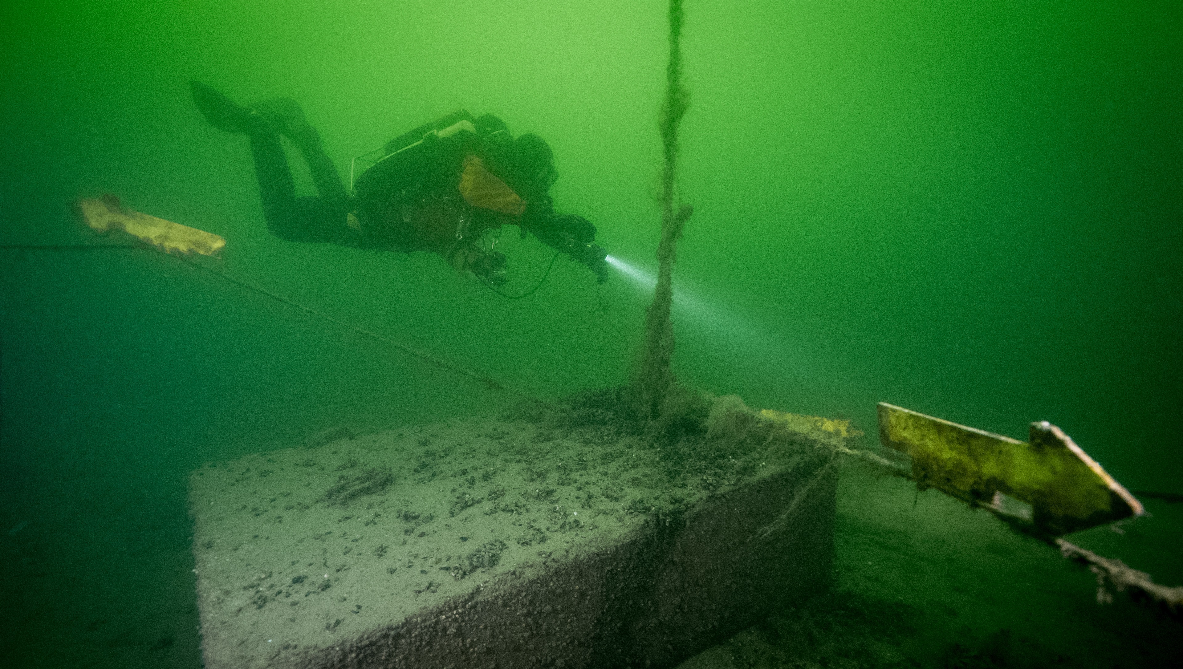
Kaapelihylky
The wreck's location is near the tip of Hankoniemi, east of the northern part of Tullholmen, on the north side of Hauensuoli Strait.
The wreck is a Dutch-type vessel, which possibly sank in 1647 or 1648. The ship had a keel made of hard wood. Among the findings are blue-patterned tile fragments that a Dutch museum specializing in tiles dated to the mid-1600s. The cargo included, among other things, grains. The construction material is oak, and the vessel was single-masted.
The wreck's length is 18.40 meters, and its width is 4.90 meters. The bow and stern are severely damaged, and the side planking is badly scattered, but the shape of the ship's hull is clearly visible. The sides are upright up to the deck beams, and sturdier structures like the bow framework are in place.
The wreck got its nickname "Cable Wreck" because a cable was once laid over it.
A survey of the wreck was conducted in 2013 because funding for the preservation of the wreck was granted to reduce the harmful effects of anchoring. It was observed that the rudder is no longer visible (under the sediment?), and the anchor winch is worn and almost unrecognizable. A significant amount of sediment has accumulated over the wreck, but its shape is still distinguishable. A side-scan sonar image of the wreck is available in Rami Kokko's survey report from 2015 (see page 13).
The wreck was one of the targets of the Baltacar project (2017-2019), and during the project, its own Hauensuoli wreck park was established. During the active diving season, there is a buoy on-site for boat mooring and divers' descent. Guided diving routes are available on the seafloor, and underwater cultural heritage information signs have been attached both underwater and at Hauensuoli pier.
ㅤ
Kobben itäpuoli
The location is in the Hauensuoli area of Hanko, east of the northern part of Tullholmen, at a depth of about ten meters. The bottom consists of easily stirred mud and sand.
There is the wreck of a wooden, smooth-sided vessel at the site. The remaining part's length is about ten meters. The vessel appears to have been single-masted. The bow and stern are damaged, and one side remains almost up to the gunwale (nine strakes observed). Part of the deck is still preserved, and a small hatch is visible.
The wreck has been known since the 1960s when Ora Patoharju mentioned it in his notes as a schooner or yawl. The wreck was marked on the Finnish Sport Divers' Federation's map drawing in 1976, related to the federation's archaeological fieldwork at the time. The wreck was also discovered during underwater inventory in 2007-2008 conducted by the National Board of Antiquities' Maritime Archaeology Unit in the Hauensuoli area.
ㅤ
Kobben Koillinen
Near the tip of Hankoniemi, east of the northern part of Tullholmen, on the northeast side of Hauensuoli Strait, there is a large section of a wooden ship, possibly the stern part. The wreck part lies on a guided diving route between the wrecks Kaapelihylky (1392) and Kobben itäpuoli (2586).
The length of the wreck part is about 10 meters, and its height is about 5 meters. On one side, there are frames and internal ceiling planking.
This possible section of a shipwreck may correspond to the anomaly mentioned in the 2007 survey report east of Kobben's northern tip (Kokko 2007, p. 13). However, this target was not able to be inspected by diving at that time. Unfortunately, the side-scan sonar image is somewhat inaccurate due to poor survey conditions. The goal is to re-survey the area under better conditions and obtain precise location information for the target.
ㅤ
Lilla Ankargrundet
The wreck's location is east of Tullisaari in Hanko, at the northwest tip of Lilla Ankargrundet, partially within a small cove on the northwest tip.
The wreck is a large and partially disintegrated wooden ship, with the largest intact section measuring about 31 x 6 meters. Other sections are approximately 15 x 6 meters, 19 x 5 meters, 6 x 4 meters, and 3 x 6 meters.
The wreck was already known in 1976 when it was marked on the Finnish Sport Divers' Federation's diving camp map. The National Board of Antiquities' Harry Alopaeus made a preliminary sketch of the wreck in 1989. It is believed that the wreck could be the park ship Ajan, which wrecked on November 24, 1890. The vessel was carrying ballast and heading to Lappvik. Its homeport was Lemland in Åland.